“Feels Like September”: Atlantic Disturbance Could Be Upgraded To Tropical Storm Beryl This Weekend
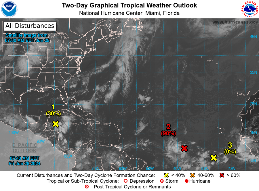
The National Hurricane Center is tracking three tropical waves, one of which could develop into Tropical Storm Beryl this weekend.
As of 0800 ET, NHC said the tropical wave about 1500 miles east-southeast of Windward Island is “gradually becoming better defined,” indicating a 90% chance of strengthening into a tropical depression or storm over the next 48 hours.
The two other storms, one a low-pressure system over the western Caribbean Sea and the second several hundred miles south-southwest of the Cabo Verde Islands, both have a low probability of developing over the next two days.
Here’s a map of all three systems NHC watches into this weekend:
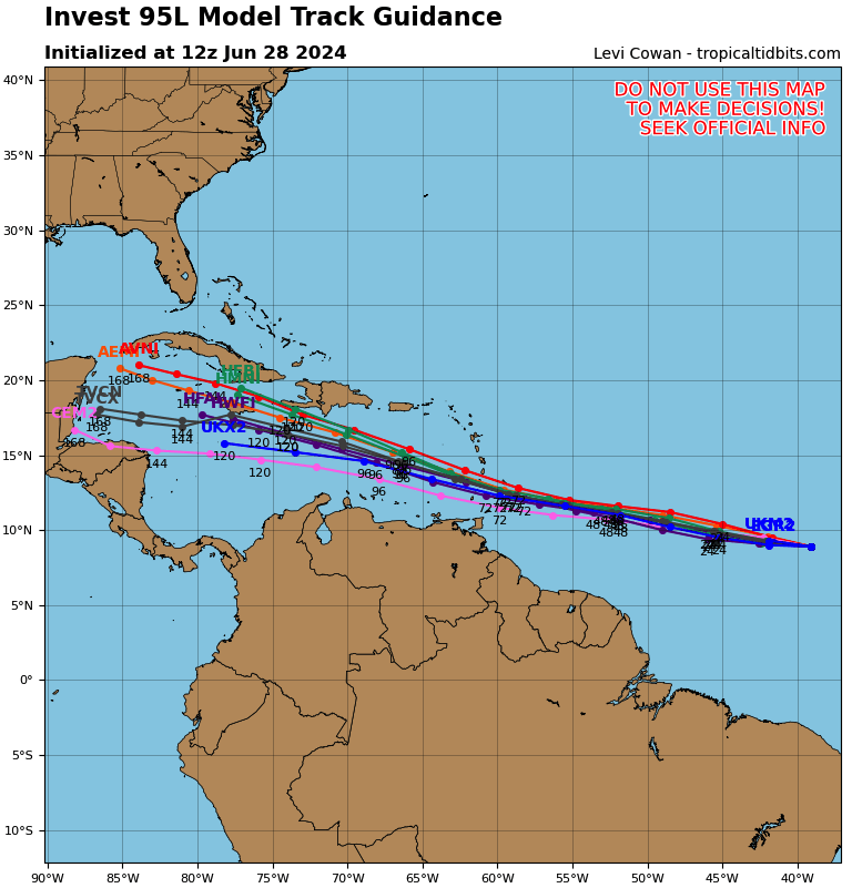
Global weather models show that the tropical wave with the highest probability of forming 1500 miles east-southeast of Windward Island could end up in the southern Caribbean Sea.
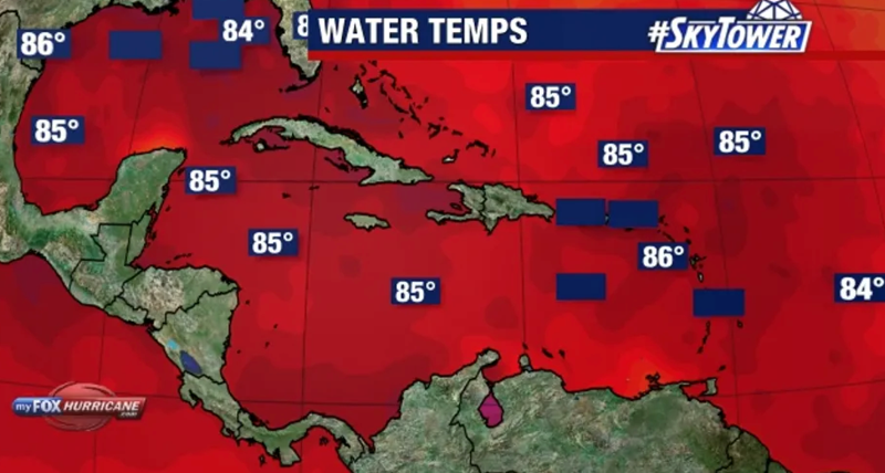
Tampa’s FOX 13 Meteorologist Dave Osterberg said, “We don’t typically track storms like this in late June, but record high temperatures in the western Atlantic are leading to more tropical activity.”
“It feels like it’s September to the water down here, rather than late June,” Osterberg said, adding, “And that’s why this is beginning to develop, and it’s going to develop as it moves into the eastern Caribbean.”
Osterberg added that several computer models have this system developing into hurricane status.
While the models don’t show any of the three systems threatening the US Gulf Coast, we have outlined that the Biden administration must contend with the La Nina weather phenomenon, which is expected to fuel an active Atlantic hurricane season. These storms could disrupt major Gulf Coast refineries, driving average gasoline prices at the pump to the politically sensitive $4 a gallon.


